
Featured Projects & Geodetic Case Studies
From 250MW utility-scale solar parks to 65-story urban high-rises and residential subdivisions — examine how our millimeter-precision surveys safeguard multi-million dollar investments.
Real-World CAD Transformation: Raw Land vs Contour Mesh
Drag the interactive slider to inspect how our field DGPS and robotic total station data is processed into layered civil CAD deliverables.
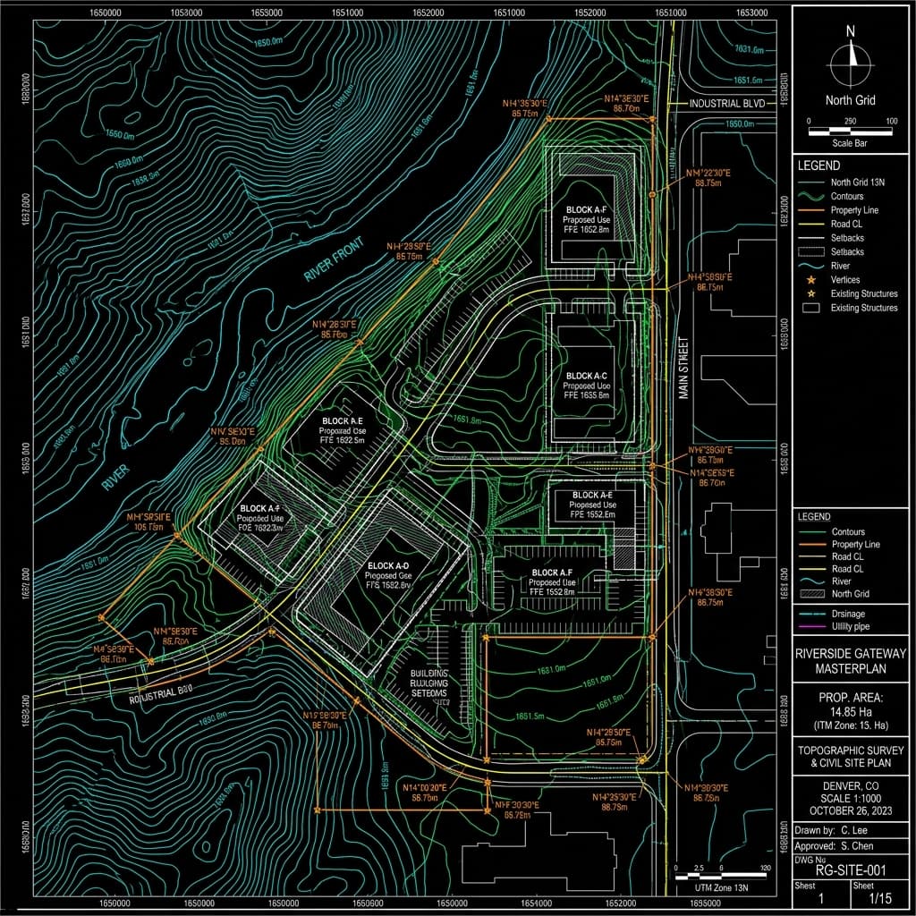
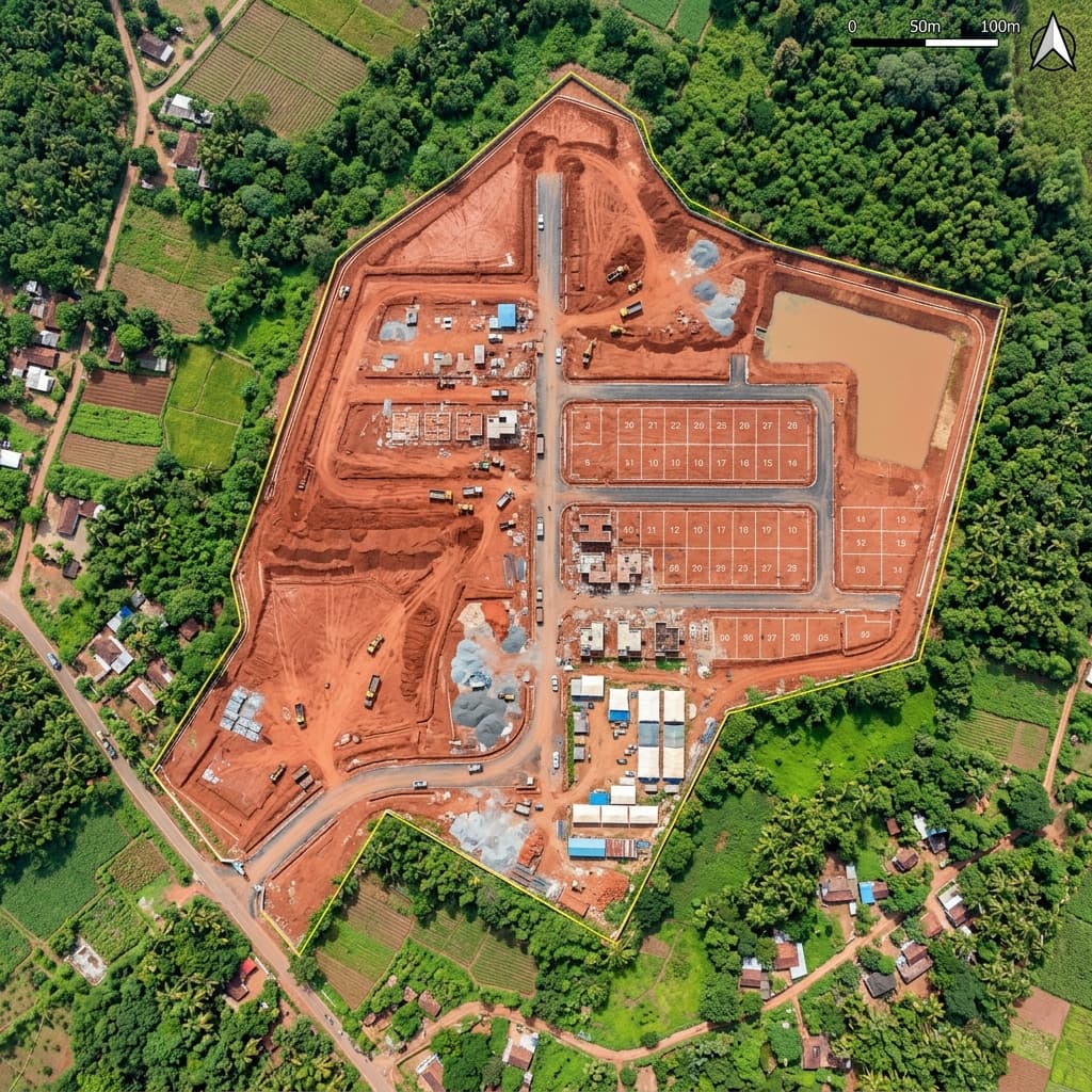
Multi-Layered .DWG / .DXF
Organized in 18+ industry CAD layers (Contours, Boundary, Setbacks, Utilities).
Legal Surveyor Stamp
Certified by licensed surveyors with verified revenue boundary reconciliation.
Sub-Centimeter RTK GNSS
Georeferenced to national geodetic datums with permanent on-ground benchmark pillars.
Detailed Project Case Studies
In-depth technical breakdown of challenges, solutions, and deliverables.
37-Acre Rubber & Spices Plantation Hill Slope Topographic & Boundary Survey
Complete 3D digital terrain modeling and boundary demarcation for a 37-acre undulating rubber and spice estate in Ponkunnam to plan hillside terracing, natural drainage channels, and official family partition boundaries.
Dense rubber tree canopy and steep 35-degree rocky hill slopes obstructing traditional optical lines of sight.
Deployed multi-frequency RTK DGPS control points on clearing ridges combined with robotic electronic total stations along internal footpaths to capture 0.25m elevation contours.
Key Impact Stats
Commercial Retail & Multiplex Setting Out & Column Grid Layout
Provided continuous precision column setting out, foundation pile centers, and floor level elevation transfers for a multi-level commercial complex in the heart of Pala.
Tight urban plot boundaries adjoining main arterial roads with zero tolerance for setback deviations under Pala Municipal bylaws.
Established dual permanent bedrock reference monuments and conducted pre-pour column axis verification before every concrete casting stage.
Key Impact Stats
28-Acre Residential Villa Layout Subdivision & Boundary Demarcation
Complete boundary reconciliation with historical village revenue records, internal 9-meter road network design, and physical concrete monumentation for 110 premium residential villa plots.
Complex historical boundary claims and overgrown boundary ditches along neighboring private properties.
Conducted joint mathematical reconciliation using certified revenue sketches and permanently pegged all 440 plot corners with durable concrete survey pins.
Key Impact Stats
15-Acre Mixed-Use Commercial Estate DGPS & Contour Survey
Comprehensive 15-acre DGPS land boundary demarcation and 3D contour topographic survey covering natural terrain levels, boundary verification with revenue sketches, and civil engineering site plan preparation.
Irregular plot geometry with dense perimeter tree cover and adjoining tidal water canal requiring seamless geodetic coordinate integration.
Established high-precision DGPS base-rover RTK control points tied to the national geodetic grid and deployed robotic total stations to measure all internal topography and boundary coordinates.